|
|
The 29th Annual GIS in Action Conference April 19th - 22nd, 2021
|
|
|
We welcome you to our 4th quarterly Newsletter! Thank you for your ongoing support and feedback on the ORURISA's previous Newsletter editions. Through your valuable feedback, we received overwhelming support and some great ideas. We have incorporated your feedback into our 4th edition. We aim to explore, expand, and reshape the content of forthcoming Newsletters together, to meet the needs and add value to ORURISA membership.
We hope that you will find great value in its content and that it will aid you in your own goals to grow and thrive. |
|
|
|
|
|
|
Welcome to the latest Oregon and Southwest Washington URISA newsletter. This exciting quarter will be kicked off by the return of GIS in Action after a hiatus in 2020 due to you-know-what. I, for one, am thrilled to see its return!
The 2021 Conference Committee, composed of members from ORURISA and Cascadia Region of ASPRS (American Society for Photogrammetry and Remote Sensing), has been innovating and tirelessly working to bring you an array of informative keynote addresses, workshops, and presentations. This year’s theme, Resilience and Equity, is important and timely given the events of 2020 and 2021 and represents an opportunity for discourse among colleagues, peers, and beyond. With its selection of topics that span local to global issues and applications, the conference promises to be an eye-opening and valued experience long after its end. Many thanks to Alexa Todd (Conference Chair) for leading the effort, along with Shivon Van Allen (Program Chair), Cy Smith (Sponsorship Chair), and the many others who have endeavored to create an extraordinary virtual conference experience!
Looking forward to the rest of the year, expect to see continued Chapter innovation led by soon-to-be new president Keith Massie, starting April 21, during the Annual Chapter Meeting*. (As a member, you are invited to attend this annual meeting; please see below.) Work on the horizon includes continued progress toward goals articulated in the ORURISA strategic plan defined by the Board of Directors for 2021 and beyond. At the heart of the strategic plan lies the Board’s unwavering commitment to maintaining and improving benefits for all of our members and supporters. This is and always will be our promise and debt to you.
More specifically, the Board and volunteers will navigate renewal of the Chapter’s relationship with URISA International to ensure expansion of benefits for Chapter members and friends starting later this year. To achieve this objective, the Chapter will introduce a sponsorship program designed to increase organizational flexibility and offerings for the entire GIS community in Oregon and Southwest Washington. The sponsorship program is part of the effort to diversify our revenue streams. Please watch for the program launch in the next 2 to 3 months.
One of the best ways to gain from being a member is to get involved. The organization is entirely volunteer driven and so your involvement will drive Chapter direction and offerings. As a Board member, you have a direct vote for Board actions and resolutions that lead to Chapter activities and overall direction. At the Annual Chapter Meeting* (April 21; see below), you will have the opportunity to hear from Board members and to vote on two incoming At Large Board members. We are accepting nominations (self-nominations included!) until April 17. Please sign in with your ORURISA username and password to fill out the form. You will use the same login information to vote beginning April 21. The Board of Directors is an energetic group of individuals working together to do great things for and with the GIS community. It would be fantastic to have you join us!
If you just want to be involved and support continued success, we have spots for you too. We are in need of volunteers to contribute content and compose the quarterly newsletter; lead programs such as the nascent sponsorship program; develop communications like podcasts; lead trainings and workshops; coordinate volunteers; and perform website administration. If you are interested in any of these, please contact us.
With the Annual Chapter meeting on April 21, my term will come to an end. Thank you for your support during my tenure as president of this great organization. I appreciate your willingness to try new approaches and keep your sights on a return to a new and better normal. The past two years have been a tremendous opportunity for me to get to know many of you and to help guide the Chapter through unprecedented change, apprehension, grief, and success. It has been a wonderful honor to work alongside and to serve you.
To close, I wish you a very happy spring and successful 2021. Please keep in touch via my new email address, pastpresident@orurisa.org, to take effect April 22. (At the same time, Keith will assume the president@orurisa.org email address.)
Sincerely and warmly yours,
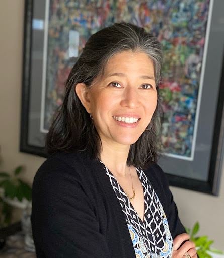
Theresa Burcsu
* You are invited to the Annual Chapter Meeting to be held at 12PM Pacific time as part of the GIS in Action conference. Members not attending the conference may also attend this annual meeting. Please look for more information on the ORURISA home page under "upcoming events" and by email in the coming days. |
|
|
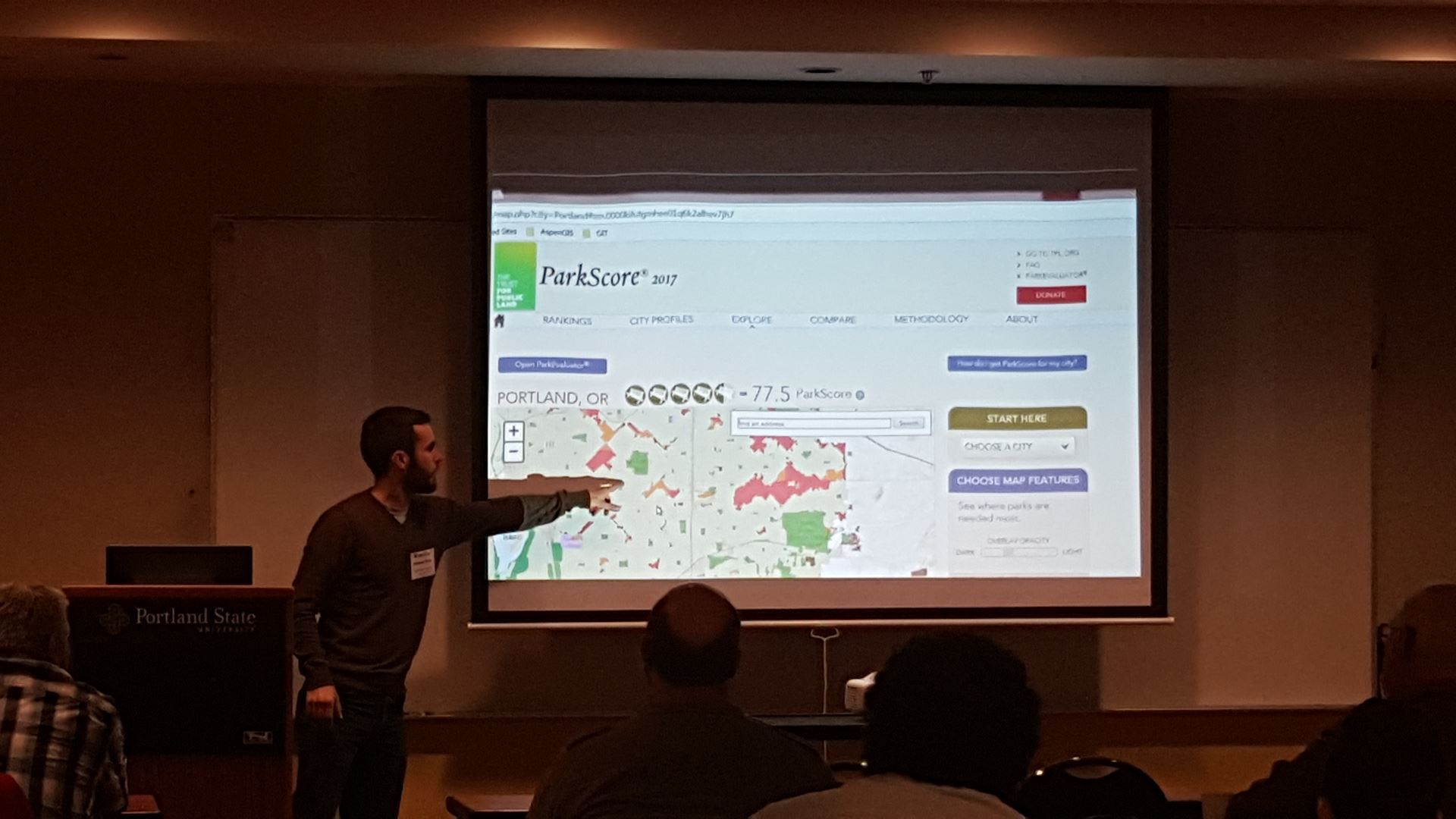
Story of The GIS in Action Annual Conference
The GIS in Action annual conference committee was formed in 1992 by two volunteers Roger Crystal and Dick Bolen, the same year as the ORURISA Chapter's initiation. The Chapter's two-day yearly GIS in Action conference has always been planned by volunteers and co-hosted by ASPRS and ORURISA. Keith Massie and Doug Smith were the co-conference chairs for almost a decade from early 2000. In the last few years, Richard L'Esperance served as the conference chair. Alexa Todd is currently serving as the chair of the 2021 conference committee. The conference venue's location has always been in Portland to cater to the SW Washington and Oregon GIS community. For the past several years, the conference venue has been Portland State University, thanks to David Percy, to save cost and provide more resources to the student chapters, groups, or other pursuits like scholarships. Any conference revenue is distributed between the two non-profits to fund their programs that support local students and professionals. Nearly 300 individuals attend the annual event. The program showcases diverse work from geospatial professionals local to Oregon and SW Washington. Students participate from local colleges and Universities and submit their projects for the Map-Gallery contests.
Due to the COVID-19 pandemic, the 2020 GIS in Action Conference was canceled, and two virtual keynote speaker presentations were delivered using the zoom platform. Participation in last year's virtual presentations was impressive, and feedback was positive. This year the GIS in Action conference committee is working with Portland State University to deliver a fully-virtual GIS in Action conference, which you can attend from any location that is convenient to you. The conference is scheduled over four days from April 19th to April 22nd, 2021, to allow for flexibility and time management.
The 2021 GIS in Action annual conference theme is Resilience and Equity. |
|
|
2021 Conference Theme: Resilience and Equity
The theme of the 2021 GIS in Action is “Resilience and Equity” in an effort to promote conversations about how our geospatial work can be improved and contribute to the recovery and rebuilding of a more just society. The program features content from our talented and passionate community of professionals and students with a variety of presentations that speak to how GIS is being used to identify issues, find opportunities for improvement, and work collaboratively to improve assumptions, methodologies, and results. From assessing the equitable distribution of civil services in urban and rural areas to planning and implementing emergency response for jurisdictions and utilities to documenting the current culture through mapping street art and activism in our urban areas, this year’s program highlights the efforts that are being made to embrace a year of changes and challenges and to, ultimately, emerge stronger and more self aware. |
|
|
|
|
Introducing: Keynote Speakers for The 2021 GIS in Action Annual Conference |
|
|
|
|
Karsten Vennemann
Karsten Vennemann is originally from Germany and has been living with his family in Seattle since 2004. He has been working as a GIS professional for over 20 years and gathered experience in the academic and private sectors, as well as in non-profit organizations, before founding Terra GIS, a GIS Consulting firm based in Seattle, in 2007. Karsten's background is in Geography and Soil Science, and he holds a Diploma (Master of Sc.) from the University of Stuttgart, Germany, in addition to a Master's Degree from UC Berkeley. From an early age, he has been interested in supporting environmental efforts to preserve natural resources and to protect natural plant and animal habitats. Following this lifelong passion, Karsten has worked with GIS in the context of natural resources, sustainable development, and social justice. Over the course of his career, he has served as an Environmental Scientist, GIS Analyst & Programmer, and Project Coordinator, working on various tasks including GIS project management, GIS analysis, cartography, remote sensing, development of web-based information systems, and implementation of spatial databases. In recent years, his work as principal consultant of TerraGIS has allowed him to contribute to a wide variety of projects in Europe, Africa, South America, and the Pacific Northwest (US). Moreover, for many years now Karsten has increasingly been using open-source geospatial software. He teaches classes in Open Source GIS and a good portion of his work as a consultant involves creating and supporting open-source-based Web GIS solutions. Throughout the last 15 years, Karsten has been a frequent speaker at GIS conferences and an active member of the OSGeo Foundation as well as the Open Source Geospatial community.
You can find more information about Karsten and TerraGIS at www.terragis.net |
|
|
|
|
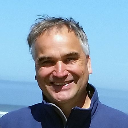
Jeff Frkonja
Jeff Frkonja is Metro's Research Center Director, a former Oregon Geographic Information Council chair, and the current OGIC regional government representative. He has spent more than two decades working in and for the public sector on data development, GIS systems, decision-support analytics, and information governance. In his spare time he enjoys using his spatial senses to navigate the awesome outdoor opportunities in the Pacific Northwest. |
|
|
|
|
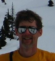
Steve Hoffert Steven Hoffert is the Chief Information Officer (CIO) for the Oregon Youth Authority and the current Chair of the Oregon Geographic Information Council. He has worked in State and local government for over 25 years including the Oregon Judicial Department where he worked as the IT technical lead and Oregon Department of Forestry as CIO and spent summers supporting fires on the Incident Management Team.
|
|
|
|
|
Colleen Miller Colleen Miller is the City of Bend’s GIS Manager and serves on the Oregon Geographic Information Council as the local government representative. Colleen has an extensive background in both GIS and information technology in the public sector, both at the state and local level. When she isn’t working to enable data-informed decision making, you’ll find Colleen exploring Oregon’s outdoors on skis, by bike, or by foot.
|
|
|
|
|
Nicole D. Franklin
Chief Pro-Equity and Anti-Racism Officer
Enhanced Interactions, LLC
Nicole is a transformative and strategic Pro-Equity and Anti-Racism leader. As a technologist, she champions the non-binary realities of technology as a human right. Nicole advocates for integrating technology tools as a critical resource in race and social justice strategic planning as upstream investments, where the needs are greatest. She leverages and innovates technology to advance Equity and Social Justice to design, define and drive sustainable cross-sectional applications respected on local, regional, and national levels.
Nicole is a results-focused manager with 20 years of experience, increasing levels of responsibility and leadership in the areas of information technology, strategic planning, program management, project management, performance management, public policy analysis and key stakeholder relationship management. She develops workable, pragmatic solutions to problems faced by the unserved and underserved communities. Nicole utilizes her education and unique experience to enable organizations to advance Pro-Equity and Anti-Racism organizational development. As an Executive and Life Coach, she enjoys helping other professionals, especially those who desire to develop their Anti-Racism leadership.
EDUCATION
-
M.A, Demography, University of Pennsylvania
-
B.A. Sociology (urban studies) with Distinction, University of Washington
-
B.S. Applied Computational Math & Science (ACMS), University of Washington
-
B.S. Statistics, Minor in Pure Math, University of Washington
-
Professional Scrum Master, Scrom.org
-
ITIL Foundation, EXIN
-
Virtues Project Facilitator
-
First Aid/CPR/AED Instructor, American Red Cross
GIS for Equity & Social Justice: Equity is Spatial Analysis
Join us to hear how Equity is GIS in Action! Equity and Social Justice is how professionals are being asked to do their work. Increasingly professionals in every field from environmental science, transportation to health and beyond are being asked to deliver services equitably. How do we ensure equitable outcomes? How do we understand where the needs are greatest and implement plans of equity and social justice to close the gap so everyone thrives? Equity is a spatial analysis, GIS is key in Equity Action. |
|
|
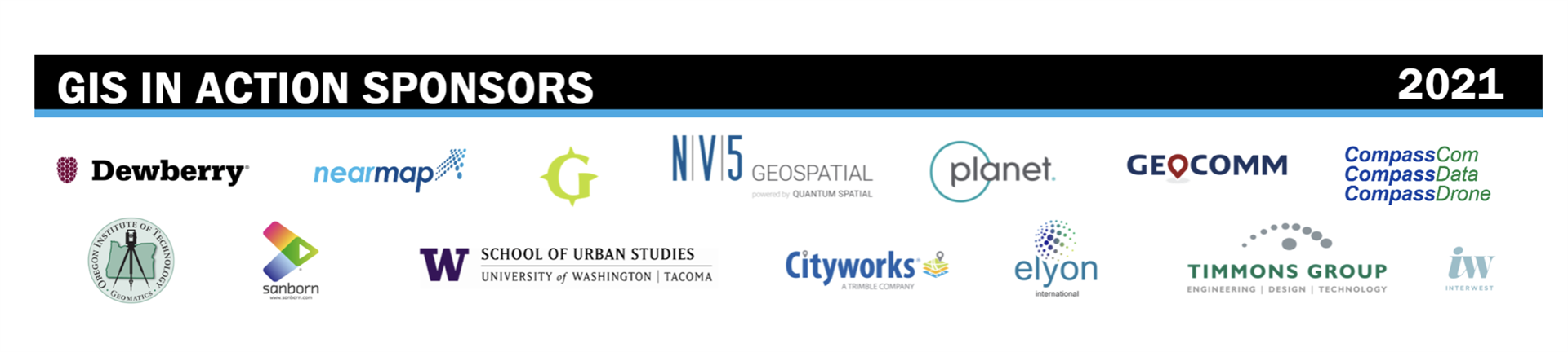
2021 GIS in Action Sponsors |
|
|
|
|
|
|
|
|
2021 GIS in Action Annual Conference Conference Registration
April 19th-22nd 2021 |
|
|
|
|
|
|
Cascadia Region ASPRS and the Oregon-Southwest Washington URISA Chapter present the 29th annual GIS in Action Conference. The 2021 conference will be a virtual event held on the week of April 19th, 2021. More details are available on our website.
You’re invited to register for the 2021 conference.
Registration for the 1st fully-virtual GIS in Action conference is intended to make attendance accessible. There is a flat $35 rate for the 4 half-days of conference. Students and anyone with financial hardship (as defined by working less than part-time) can attend the keynotes and presentations for free. Workshops are held during the afternoon for an additional fee.
The preliminary conference schedule is available online. Check back in the coming weeks as more workshops and content are added to the agenda.
Topics of interest:
For questions about the conference, please contact the GIS in Action conference committee .
https://orurisa.org/GISinAction
|
|
|
|
|
2021 GIS in Action Workshops
|
Workshops Registration
April 19th-22nd 2021 |
|
|
|
|
|
|
Day 1 Workshop: Adventures in LiDAR using Arc
Take a tour in Arc using lidar data and see the many products and tools that can be made with lidar data. Students will be provided with a dataset and full tutorial on the processes and tools that will be demonstrated.
Presenter: Debbie Barnes
Session Time: 1:00 PM - 3.50PM (PDT) Monday, April 19 2021 |
|
|
Day 2 Workshop: Understanding how your GIS is used with CMMS in the Analysis of Risk
GIS is critical to a fully functioning Infrastructure Asset Management Program. We will walk through each step of a supporting GIS to achieve the goal of assessing and analyzing asset Risk and Criticality.
Presenter: Ben Hoffman
Session Time: 3:00 PM - 4:50 PM (PDT) Tuesday, April 20 2021 |
|
|
Day 2 Workshop: Examining the legacy of redlining in the United States using the Google Earth Engine Python API
This workshop is an introduction to the ‘big data’ analysis capabilities of Google Earth Engine via the Python API, including accessing remote sensing and model data collections, calculating spectral indices, and sampling environmental variables for areas of interest. Using the ' area descriptions' created by the US ' Home Owners' Loan Corporation' (HOLC) i n the l ate 1930s (the origin of the term ‘redlining’ ) that were compiled digitally by the Mapping Inequality project, the workshop characterizes modern day environmental conditions i n the different HOLC grades using measures such as l and surface temperature, vegetation greenness, and seasonal temperature variations.
Requirements:
● A Google Earth Engine Account
● A Google account for access to the Colaboratory virtual machine environment.
Presenter: Dr. Nicholas P. Kohler Session Time: 3:00 PM - 4:30 PM (PDT) Tuesday, April 20 2021
|
|
|
Day 3 Workshop: GLOBE Observer: An example for using community science data to build and maintain your GIS capacity
The aim of this workshop is to present the latest developments in which community and citizen science are creating and contributing open-access geospatial data. With the proliferation of mobile technology that are location-enabled, there are emerging opportunities to teach foundational geospatial concepts, engage communities in quality-controlled data collection, and developing the ‘people’ component of a geographic information system (GIS). To demonstrate a process for using a citizen science tool, you will be introduced and use a mobile app developed by the NASA-supported Global Learning and Observations to Benefit the Environment (GLOBE) Program. Weather and local regulations permitting, you can go outside and collect data related to tree height, land cover, and clouds. Then we will explore and compare this type of data to authoritative geospatial data maintained by local, state, and federal organizations. Finally, we will facilitate a discussion on recommendations for key areas in which communities could continue involvement in building and maintaining maps, GIS, and the needed open access data. This workshop is sponsored by OregonView.
Presenter: Peder Vernon Nelson
Oregon State University
Session Time: 3:00 PM - 4:50 PM (PDT) Wednesday, April 21 2021 |
|
|
Day 4 Workshop: GIS for Community Resilience
This workshop is comprised of two parts. First we highlight ways that GIS can contribute to achieving community resilience highlighting case studies and share methods for community empowerment by leveraging spatial thinking and GIS. In the second portion we will introduce the activities and opportunities to engage with resilience in context of the United Nations Sustainable Development Goals and a new URISA International working group for Climate Change and Climate Equity. In this workshop we engage with attendees to identify experiences and opportunities for community engagement to address these challenges.
Presenters:
Teresa Townsend, AICP
Chief Executive Officer, Planning Communities, LLC Raleigh, North Carolina
Dr. Sheila Lakshmi Steinberg
Brandman University
Professor of GIS, Social and Environmental Sciences
Irvine, CA
Dr. Sheila Lakshmi Steinberg is Faculty Assembly President and Full Professor of GIS, Social and Environmental Sciences at Brandman University, Irvine, CA. Steinberg is an accomplished author who has published a variety of books and edited volumes. Her most recent books is co-edited volume with Dr. Steven Steinberg entitled Resilient Communities Across Geographies Esri Press forthcoming in January 2021. In 2016 she co-edited Extreme Weather, Health and Communities: Interdisciplinary Engagement Strategies for Springer Press and co-authored GIS Research Methods for Esri Press (2015). In 2014 she authored two entries (“Community Activism” and “Small Business Ownership”) and for the Undocumented Immigrants in the United States Today: An Encyclopedia of their Experiences (Ed.) Anna Ochoa O’Leary, ABC-CLIO/Greenwood Press. Professor Steinberg is also a co-author of a book for Sage Publications entitled, GIS for the Social Sciences: Investigating Space and Place (2006).
Steven Steinberg, Ph.D, MPA, GISP
GIO, Los Angeles County California
Session Time: 1:00 PM - 2.50 PM (PDT) Thursday, April 22 2021 |
|
|
Day 4 Workshop: Remote Sensing with Free and Open Source Software (FOSS): Land Cover Analysis
Discover the powerful capabilities that Free and Open Source Software (FOSS)[1] has to offer for remote sensing tasks and beyond. This 4-hour workshop will demonstrate how to perform a land cover analysis using Sentinel 2 imagery[2] using two different approaches. Participants are welcome to follow along with the workflow on their own machines if desired. Examples will include both the use of “Maximum Likelihood” and “Random Forest” classification algorithms.
The first approach will show how to do a land cover analysis on QGIS desktop (on windows), while the second approach covers how to use the Goggle Earth Engine platform(GEE)[5] (a cloud-computing-platform based earth analysis engine) to do the same. A brief overview of FOSS for remote sensing will be followed by an introduction to QGIS desktop[3] and the Semi-automatic Classification Plug-in (SCP)[4]. This covers a complete workflow of performing a land cover analysis in QGIS based on Sentinel 2 imagery at 10-meter resolution. Steps covered in this workflow include:
- Selecting and obtaining imagery (direct queries, filtering of areas and imagery parameters, and download directly via the GUI in QGIS)
- Creating a suitable band set for the land cover analysis depending on the satellite/imagery used
- Preprocessing, conversion to reflectance, and simple atmospheric correction of imagery bands
- Creating training areas for the land cover classification
- performing the land cover classification (Maximum Likelihood vs. Random Forest)
- A brief overview of post-processing capabilities
- Accuracy assessment and error correction
The second approach shows the use of the Goggle Earth Engine platform (GEE)[5] to perform a similar analysis. The use of GEE is free for academic and private purposes. Following the
workflow of the first approach example scripts will be illustrated on how to run a Random Forest-based land cover analysis on a time series of sentinel 2 and sentinel 1 imagery.
In summary, the workshop will include the following parts
1. Overview of FOSS for remote sensing tasks
2. Land Cover Analysis using QGIS and the SCP plug-in
1. Brief Overview of QGIS desktop
2. Overview of the SCP (Semi-automatic classification) plug-in
3. Land Cover Classification using the SCP
3. The GOOGLE Earth Engine(GEE) Platform
1. Brief Overview of (GEE)
2. Land cover Classification using GEE
Presenter: Karsten Vennemann
Karsten Vennemann is originally from Germany and has been living with his family in Seattle since 2004. He has been working as a GIS professional for over 20 years and gathered experience in the academic and private sectors, as well as in non-profit organizations, before founding Terra GIS, a GIS Consulting firm based in Seattle, in 2007. Karsten's background is in Geography and Soil Science, and he holds a Diploma (Master of Sc.) from the University of Stuttgart, Germany, in addition to a Master's Degree from UC Berkeley. From an early age, he has been interested in supporting environmental efforts to preserve natural resources and to protect natural plant and animal habitats. Following this lifelong passion, Karsten has worked with GIS in the context of natural resources, sustainable development, and social justice. Over the course of his career, he has served as an Environmental Scientist, GIS Analyst & Programmer, and Project Coordinator, working on various tasks including GIS project management, GIS analysis, cartography, remote sensing, development of web-based information systems, and implementation of spatial databases. In recent years, his work as principal consultant of TerraGIS has allowed him to contribute to a wide variety of projects in Europe, Africa, South America, and the Pacific Northwest (US). Moreover, for many years now Karsten has increasingly been using open-source geospatial software. He teaches classes in Open Source GIS and a good portion of his work as a consultant involves creating and supporting open-source-based Web GIS solutions. Throughout the last 15 years, Karsten has been a frequent speaker at GIS conferences and an active member of the OSGeo Foundation as well as the Open Source Geospatial community.
You can find more information about Karsten and TerraGIS at www.terragis.net
Session Time: 1:00 PM - 3:40 PM (PDT) Thursday, April 22 2021 |
|
|
Day 4 Workshop: Geographic Information Science & Technology Best Practices for Equity & Social Justice
The focus of this workshop is on emerging best practices for doing work with geographic information science & technology (GIS&T) for issues related to equity and social justice (ESJ). During the past decade many government agencies have begun to apply an equity lens to public policies, projects, and programs. On January 20, 2021, President Biden signed an Executive Order ‘On Advancing Racial Equity and Support for Underserved Communities Through the Federal Government’ that recognizes the key role of geography and IT.
This workshop will review recently published best practices on using GIS&T for ESJ, including data management, data sources, geospatial analysis, cartographic display, general visualization, and the use of dashboards – all within the context of a GIS&T to ESJ lifecycle. The workshop will also cover ideas for community involvement in GIS&T based ESJ work.
Presenter: Greg Babinski
Greg Babinski’s GIS career spans 31 years. He has worked for the King County GIS Center in Seattle since 1998. Greg originated the URISA GIS Capability Maturity Model and participated in the development of the Geospatial Management Competency Model. He is a GISP and an American Geographical Society Ethical GEO Fellow. In addition to GIS consulting, he is a GIS researcher, author, and instructor. He has spoken about GIS management across North America, Europe, Asia and Australia. Greg has also taught GIS for Public Policy as an instructor with the University of Washington Evans Graduate School of Public Administration. In his spare time, Greg likes hiking steep, narrow and dangerous trails that lead high above the clouds to awesome views.
Session Time: 3:00 PM - 4:50 PM (PDT) Thursday, April 22 2021
|
|
|
We look forward to seeing you at the 2021 GIS in Action Conference! |
|
|
2021 GIS in Action Conference Hosts:
|
|
|
|
|
|
|
|
|
Share Your GIS Story If you have a story to share, project to present, success to celebrate, comments or feedback please email Tara Kaur, Communications Director of ORURISA at: communications@orurisa.org.
|
|
|
|
|
|
|
|
|
This message has been sent to you by ORURISA
If you no longer want to receive these letters, you can unsubscribe at any time
|
|
|
|